
Doomscrolling through BlueSky and saw a post about New York State Department of Health Updates Waterbody-Specific Advice for Eating Fish You Catch. Took a look around at the Advisories by County and found this …

… which suggests that eating the fish from Hoyt Lake is okay at all?!?! Even though Scajaquada Creek, which runs next to Hoyt Lake (they are not *usually* connected but can be during heavy rain and are close enough to be hydrologically connected via the ground water system), is DON’T EAT for all fish? How does this make any sense?
Back in 2016 the the New York State Department of Environmental Conservation (NYS DEC) confirmed the presence of a harmful algae bloom in Hoyt Lake at Delaware Park and Buffalo’s Department of Public Works installed signs in Delaware Park notifying park patrons that “recreational water activities have been suspended until further notice. That includes no swimming, no boating, no fishing and no pets in the water.”
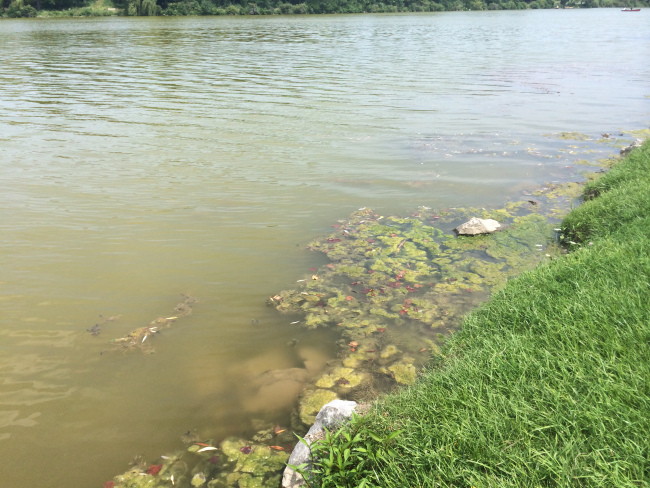
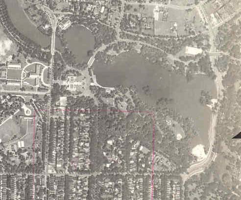
First question – who in their right mind would have been trying to swim in Hoyt Lake even *before* they announced the existence of the algal bloom?? The dead fish and the horrible smell at the Forest Lawn end of the lake should have put anyone off long before this. The image below is from 2014.
And then WIVB (dead link for the 2016 story) had this puzzling statement “The algae still has to go, but fixing the water in Hoyt Lake will require fixing the Scajaquada Creek, which no longer runs continuously through the city.”
WTH???
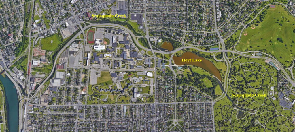
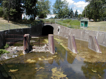
Scajaquada Creek still runs through the city – I take the bridge right over on the way to and from campus. I assume that this is an utterly mangled reference to the fact that Hoyt Lake is an artificial feature that is now mostly disconnected from the creek. The Scajaquada flows through Forest Lawn Cemetery then enters a short tunnel through a debris-collection grate. The tunnel runs through the park, bypassing Hoyt Lake, and the creek reemerges at the western end of Hoyt Lake, where is separated from the Mirror Lake section of the Lake by a cement wall. During high precipitation events water from the lake overflows the wall into the creek.
Apparently when Frederick Law Olmsted designed ‘The Park’ which completed construction in 1876, the Lake aka ‘Gala Water’ feature was originally 42 acres (or 46.5-acres?), formed by damming the Scajaquada, and there were small wetlands at either end. A bridge was built over the western end of the lake in 1874, demolished an replaced by an iron bridge in 1890, and then replaced again in 1901. There was also boathouse was constructed in 1875, then demolished in 1900.
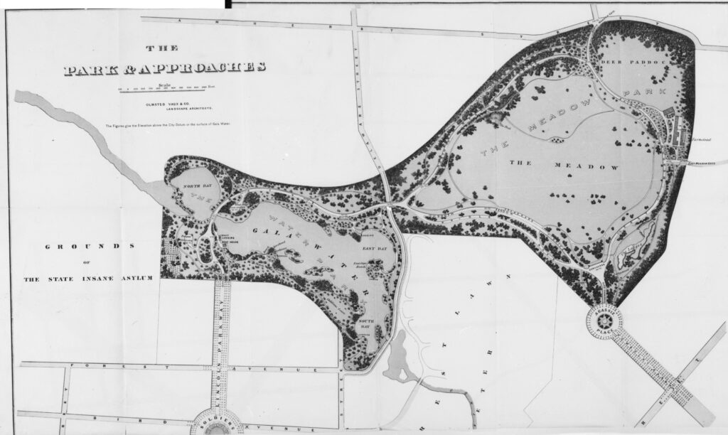
Parts of this original design were destroyed when the grounds were used for the 1901 Pan Am Exhibition of 1901. For example, this is why the original boat house was demolished to make way for a larger three story building, and there was a third iteration of the bridge. According to one source, the Lake became the ‘”Venetian Lagoon”, complete with a gondola and an electric fountain’ (https://www.olmstedinbuffalo.com/the-park-delaware-park/) but on the map of the exhibition grounds, the electric fountain is in the section labeled North Bay.
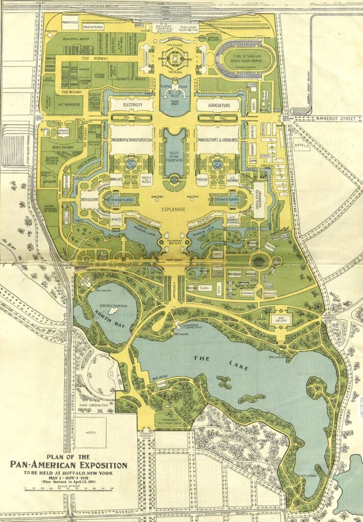
Creator Mabel Barnes Arms & White, Buffalo, NY
Composite image taken from two separate images of the map found on adjoining pages of a book. Source: Wikipedia
The follow up after the Pan Am was basically a trash fire and virtually everything built for the event (with few exceptions like the Historical Society building) was torn down, and it is rather vague exactly how this impacted the creek or the lake. The sequence of events that follows is somewhat unclear as the sources I have read are a bit contradictory or nonspecific.
In the 1950s a study by the Erie County Health Department declared the ‘Delaware Lake’ a health hazard due to the sewage overflows into Scajaquada Creek, and it was closed to the public.
During the construction of the Scajaquada Expressway (Route 198) in the 1960’s, part of the the Lake filled in and another part was cut off. Segregation By Design has a good video showing the regional impact of the roads construction (see below). To try and protect the Lake, the creek was rerouted into two conduits under the park in the 1970s. The inlets are near Forest Lawn Cemetery and the outlets west of Lincoln Parkway, the section behind the Historical Society called Mirror Lake, where a narrow dam usually keeps them separate except under high flow situations, like heavy rain, when the water overtops the dam. This almost completely isolated the lake.
Since there is extremely limited flow in the lake it is now occasionally refilled using a fire hydrant (located near the Forest Lawn side of the park on the opposite side of the lake from the finger dam inlets) when the water level drops. Besides the hydrant, it is unclear exactly what the source of the water to the lake is, but according to one report it is supposed to be from ‘wells’ – though that seems odd. Unless the hydrant is being fed by ‘wells’? A Buffalo News article (The Best Way to Honor Hoyt Cleanup of the Park Lake was His First Issue Apr 6, 1992) mentions “a steady flow of natural spring water into the lake.” This also seems odd?
The Lake was renamed in honor of Common Council Member William B. Hoyt in April, 1992, who worked for over 20 years to restore the park and protect the the lake from pollution. He died in late March, 1992 after suffering a heart attack on the floor of the Assembly.
A $50k fountain was installed in the Forest Lawn Cemetery end of the lake in 2013, mostly in order to help aerate the water in the lake to prevent algal blooms, but the pump for the fountain kept breaking which lead to more periods of algae and stink. I confess – I usually did’t notice if the fountain was going or not since I am usually to busy paying attention to traffic. It was fixed to work in 2017, and it worked for awhile. I have no idea what the current status of the fountain.
Right – so anyhow, see why I named this Ramblings? – I really don’t think anyone should eat the fish from the Lake. I don’t see how the water quality there is that much better than the creeks, plus, because the lake is isolated, all the winter salt and other runoff ends up in the lake. Ick.